
%20(3)_edited.jpg)

Real Estate Photography
Drone real estate photography captures stunning aerial views that highlight properties from unique angles, giving potential buyers a full perspective of the home and its surroundings. With high-resolution photos and videos, drones showcase property size, landscaping, neighborhood features, and architectural details that ground photography can’t capture. This modern approach helps listings stand out online, attract more attention, and give clients a professional edge in today’s competitive real estate market.


The mission
Disciplined aerial overwatch and real‑time situational awareness to enhance safety, protect assets, and support clients responsibly as a civilian service provider.


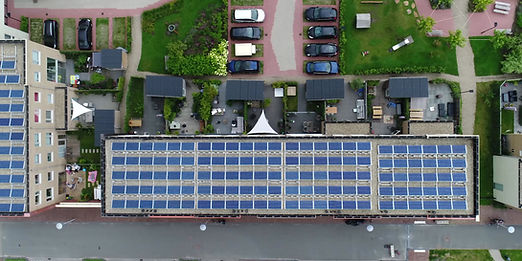
Construction Site Monitoring
Track and monitor construction progress with monthly photo & video updates, collect valuable data, and showcase your completed work.
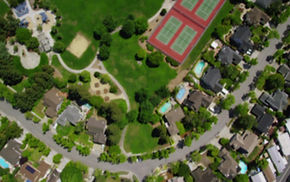
Real Estate Photography
Sell your listings faster with click-worthy aerial imagery. Showcase your property from beautiful angles and attract premium buyers.
We specialize in providing aerial overwatch for properties, VIPs, and equipment Our state-of-the-art drone technology ensures safety and security from above, giving you peace of mind. Trust us to deliver high-quality surveillance and monitoring services tailored to your needs. Experience the difference with our expert team dedicated to protecting what matters most to you.

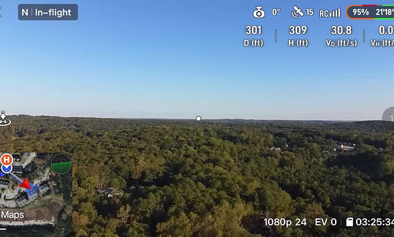
Long Range Flight
SureTrak’s long range aerial platform delivers extended endurance flights and a rock steady data link, giving operators uninterrupted high resolution real time video and precise geolocated tracking far beyond typical sightlines. It is ideal for site inspections, perimeter overwatch, and large area monitoring while maintaining strict safety and regulatory compliance.

Contact Us
Get in touch with us to discuss how our aerial photography services can add value to your projects.